Mapping Guide for SahysMod

 
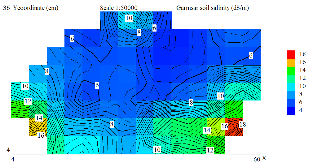
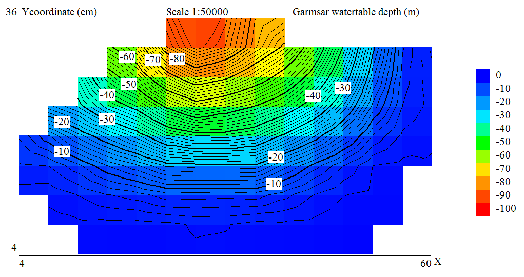
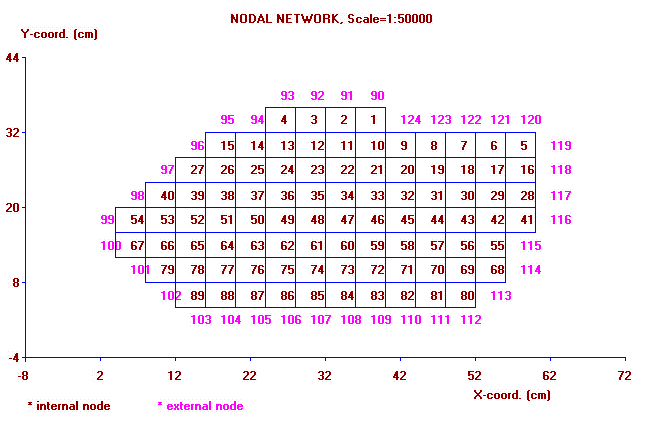
The following figure shows a network map as made by SahysMod covering fully the alluvial fan of Garmsar, Iran

                    map of Garmsar
Click below
for
category
selection

Software
& models

Articles
& manuals

Published
reports & cases

Particular
reports & cases

FAQ's
& papers

Home
page
 
                    The alluvial fan looks like this from the air:

                    map of Garmsar

 
                        Example of contour map made with QuikGrid using SahysMod output data:

                        salinity of Garmsar
                        How is such a map made?
 
                        A description of the construction of a QuikGrid map with SahysMod output data and
                        with intermediate use of MsExcel and MsNotepad is presented in Mapping Help,
                        while an application to the Garmsar case is shown in SahysMod cases.
 
 
                    Another example of a QuikGrid contour map, this time concerning the watertable depth:
 
                    watertable of Garmsar

 
                        With GIS or similar software, the maps can look more sophisticated, like this example from a study in the Punjab, Pakistan
                        (please take into account that this is a poor scan from a ShaysMod study in 1989, when it was still called RSM)

                          Model application in Punjab